Our journey to Damascus was specifically to do one thing - ride the Virginia Creeper Trail on our Lectric eBikes Here's how that went, and what you need to know before you go.
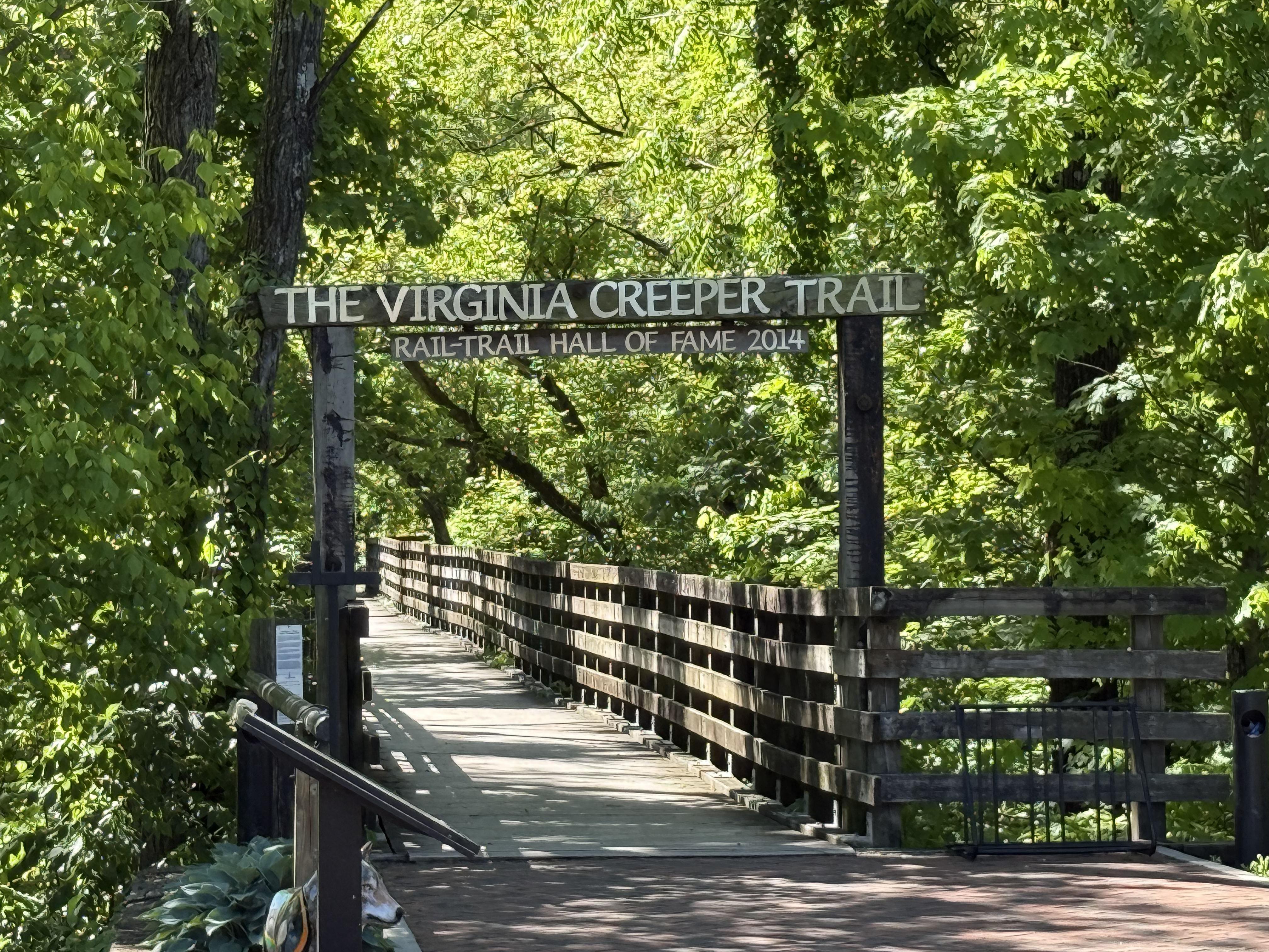
The Virginia Creeper Trail is one of those places that has accumulated a lot of adjectives over the years: most 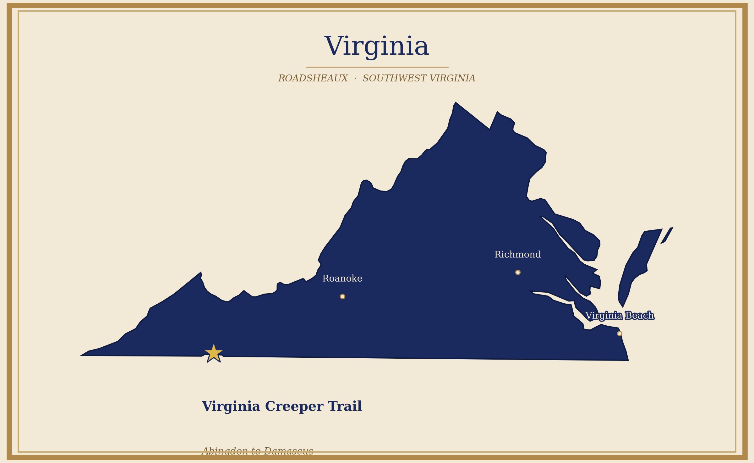
The History
The trail follows what was once the Abingdon Branch of the Norfolk and Western Railway. The line opened in 1887 as the Abingdon Coal and Iron Railroad, and by 1905 the Hassinger Lumber Company had pushed it up to Konnarock and on into North Carolina, hauling timber, iron ore, supplies, and passengers through some of the highest terrain in the eastern United States.
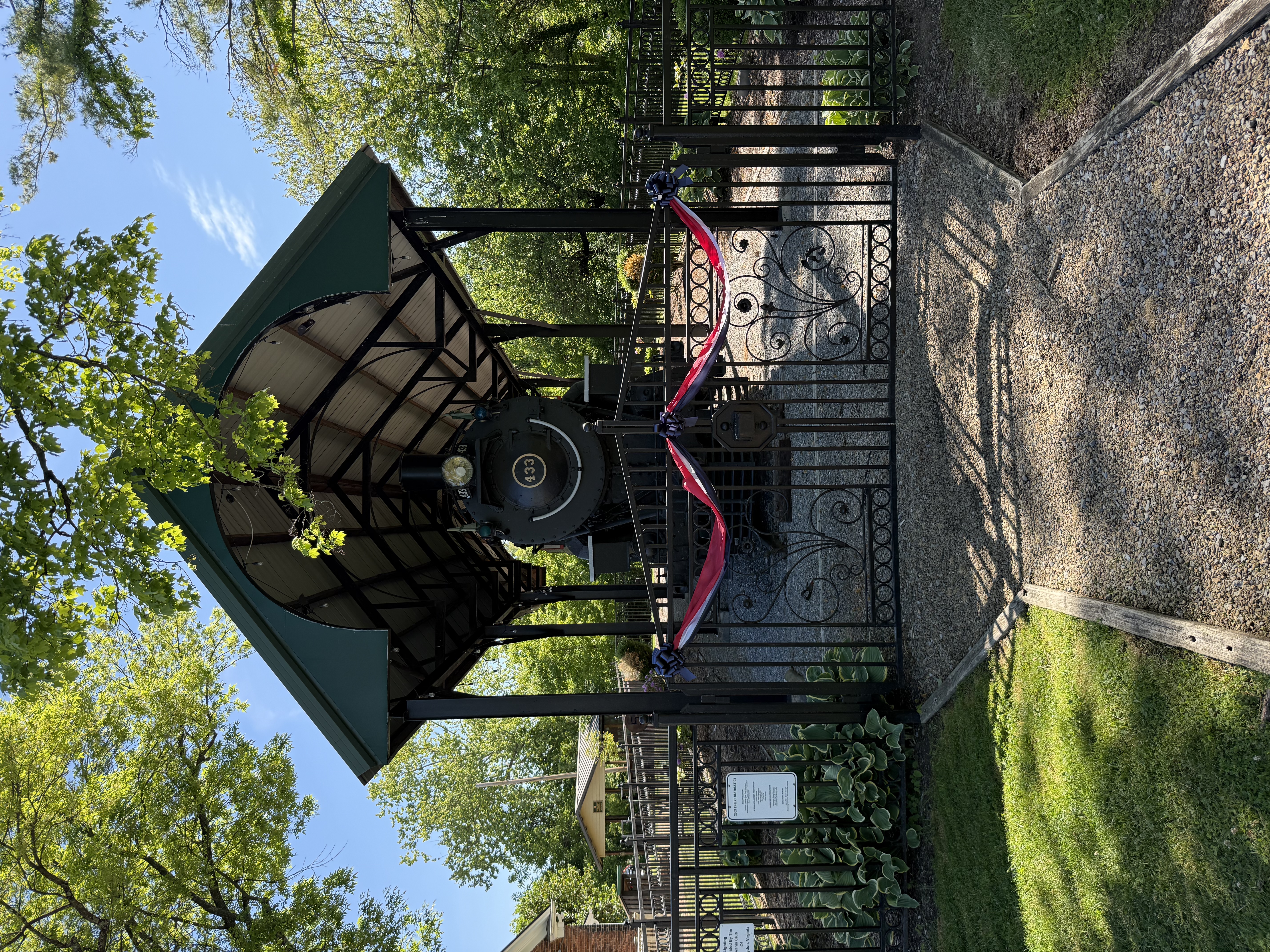
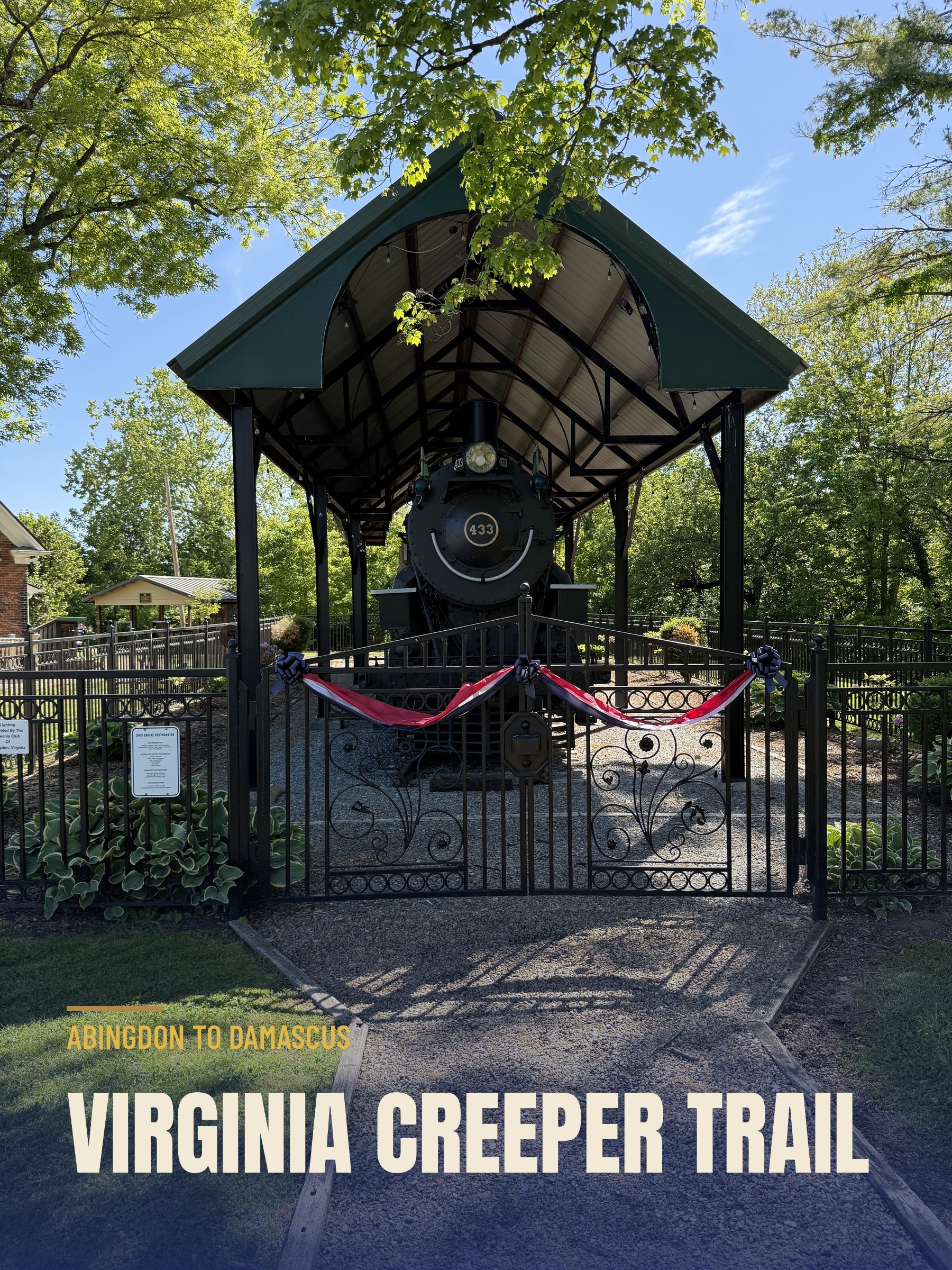
The nickname tells you everything. The "Virginia Creeper" was the twisting mountain route and the slow crawl of the trains, held in places to about 5 MPH as the early steam locomotives labored up the steep grades. With 47 trestles, sharp curves, and constant rock slides and washouts, it was one of the more dramatic rail lines in the region. The Creeper ran its last train in 1977, the right-of-way was rescued from salvage, and the corridor became the Virginia Creeper Trail. The original engine, N&W Locomotive Class M #433, sits on display at the Abingdon trailhead today.
About the Trail
The Virginia Creeper is a 34.3-mile shared-use rail trail from Abingdon, Virginia to the North Carolina line just past Whitetop Station, open to bikes, hikers, runners, and horses. It runs through farmland and fields, deep forest, and Christmas tree farms, follows Whitetop Laurel Creek, one of the finest trout streams in Virginia, and crosses nearly 50
wooden trestles, some of them more than 100 feet above the gorges below.
The trail splits into two very different halves at Damascus. The upper half, the climb toward Whitetop, is the dramatic and heavily photographed section: the big trestles, walls of rhododendron and mountain laurel, and a long downhill run along Whitetop Laurel Creek. The lower half, down to Abingdon, is flatter and more pastoral, open farmland and a long stretch beside the South Fork of the Holston River.
One thing to settle before you plan a trip: Hurricane Helene came through in September 2024 and hit the upper half hardest, and the stretch toward Whitetop is closed for major reconstruction, estimated to reopen in late 2026. As of our May 2026 visit, the open section was the lower half, Abingdon to Damascus, so that is the one we rode. The upper half is the part most people come for, so we will be back. Check visitdamascus.org for current status before you go.
How We Did It: Adventure Damascus / Sundog Outfitters
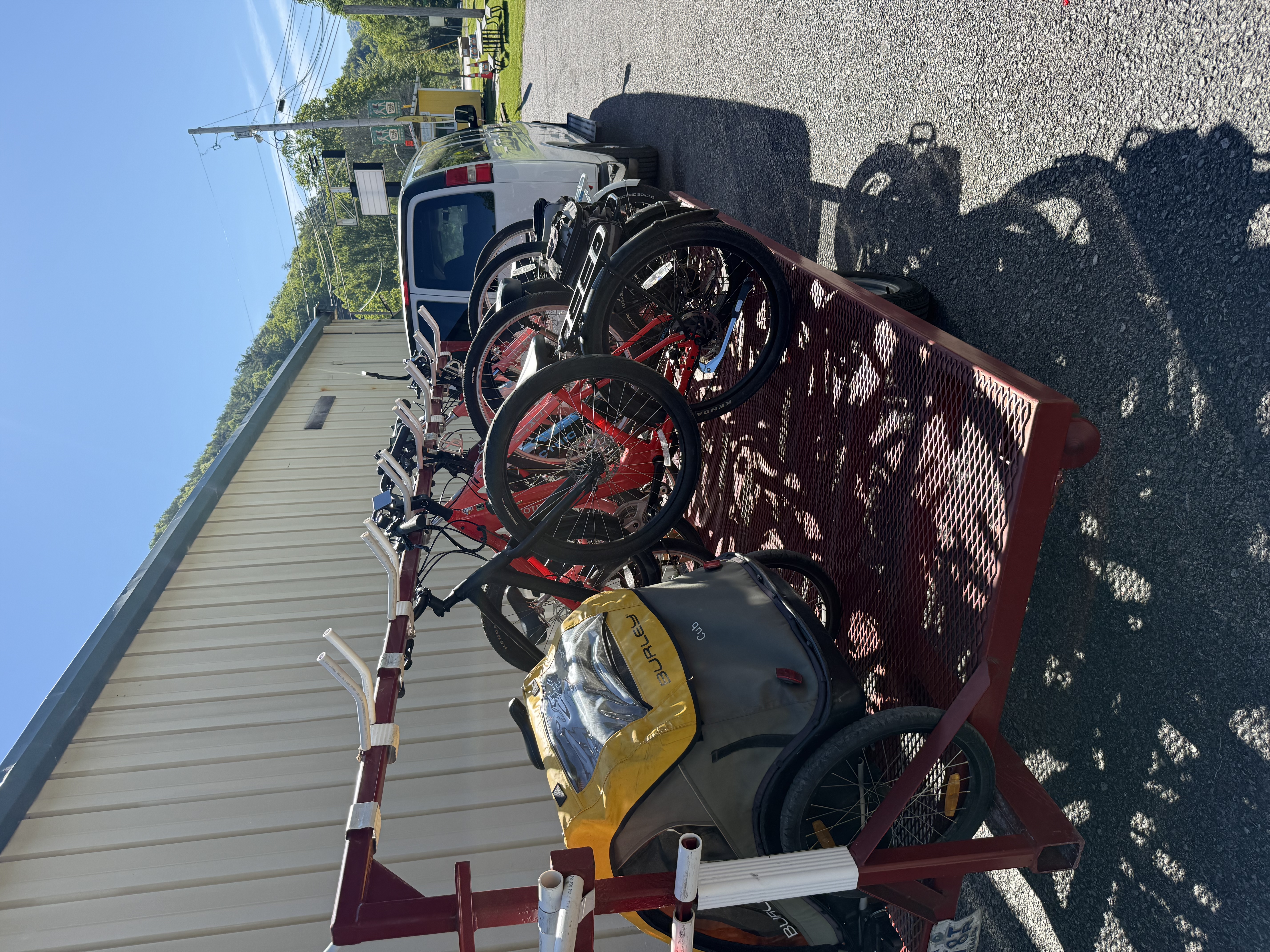
We started at Adventure Damascus / Sundog Outfitters in downtown Damascus. They offer bike rentals and shuttle service up the trail, which is the standard way most people tackle the Creeper. You rent your bike, get loaded onto a van with a specially designed bike trailer, and they haul you to your starting point. You ride back.
One thing to keep in mind: get reservations. During AT Days weekend, the outfitters were busy. We had ours sorted in advance, which I'd recommend regardless of when you visit. The shuttle logistics involve coordinating vans and trailers, and walk-ins during busy periods may find availability limited.
The Ride: Damascus to Abingdon
With our Lectric eBikes unloaded at the Abingdon trailhead, we pushed off. The lower section runs flat to gently rolling

the whole way, following the old railroad grade that, by design, never climbs or drops steeply.
The scenery on this half is pastoral and open. We rolled through farm country, crossed the South Fork of the Holston River again and again on wooden trestles, and spent long stretches alongside open fields with mountain ridges framing the edges of everything. It is not the gorge-and-rhododendron drama of the upper section, but on a clear May day it was genuinely lovely. Wide skies, green hills, and the sound of water running under us every time we crossed a trestle.
We stopped at Alvarado Station partway through to stretch and took it in. It is a small historic railroad depot community along the trail, and standing there it was easy to picture the way the route used to work, hauling timber and iron ore out of these mountains on steam-powered narrow-gauge locomotives. There we were able to get out and enjoy amazing views of the South Fork of the Holston River running alongside the trail.
As we closed in on Damascus, the trail dropped us right into the heart of downtown, where the AT Days banners were
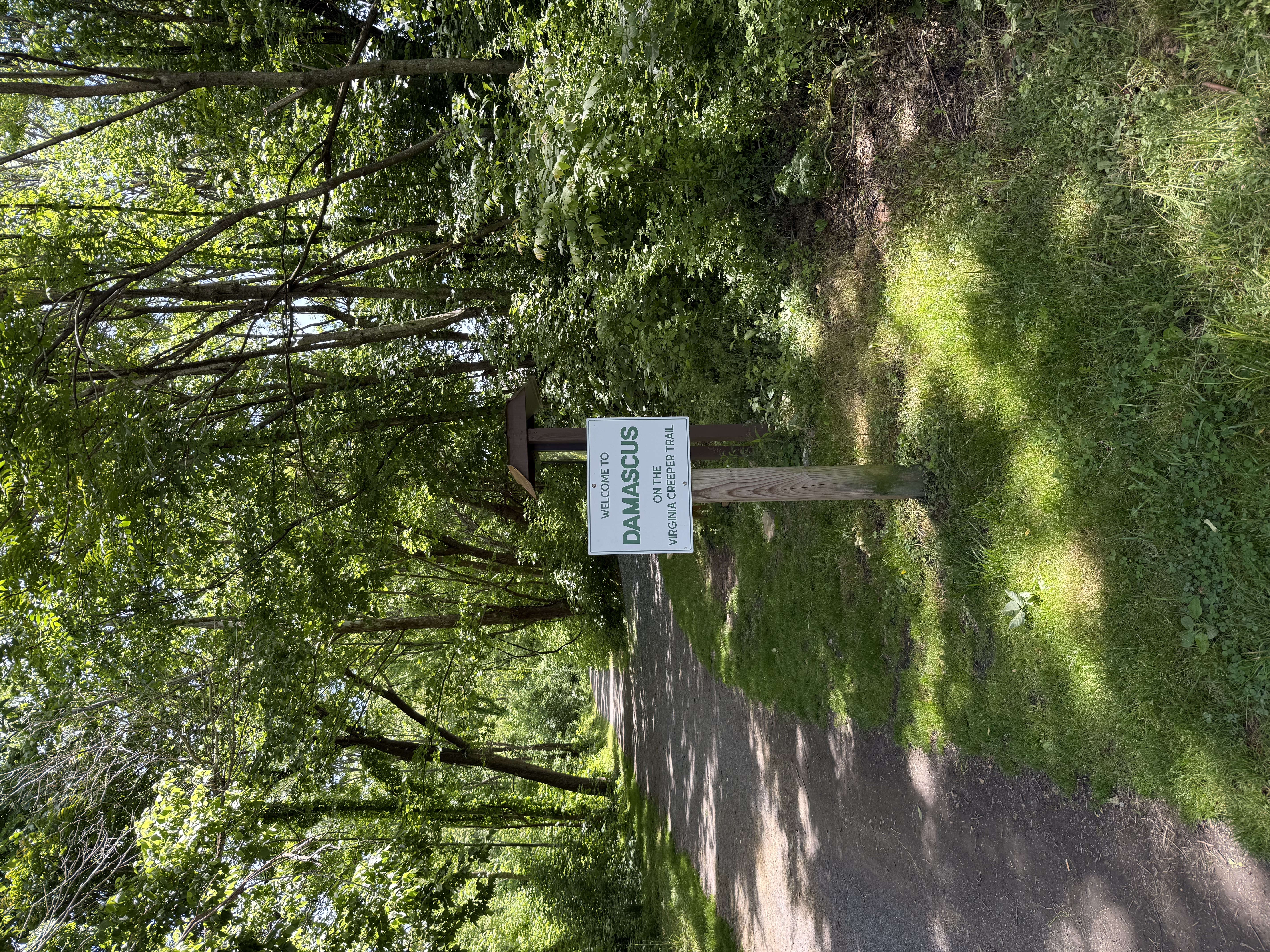
strung across the street and the whole town had that good kind of controlled chaos going. We rolled back into the Adventure Damascus trailhead having covered about 17 miles under a good sky. A solid afternoon.
We're planning to come back when the upper half reopens. The lower section is worth the trip on its own, but the upper section through the Jefferson National Forest and over the big trestles is supposed to be something else.
Gallery